

Vaisala RoadDSS Road Condition displays weather and surface observations from Road Weather Information Systems (RWIS) connected to the Vaisala RoadDSS Data Service.
Users have access to the following:
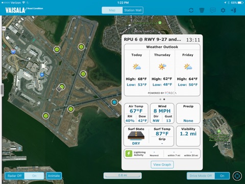
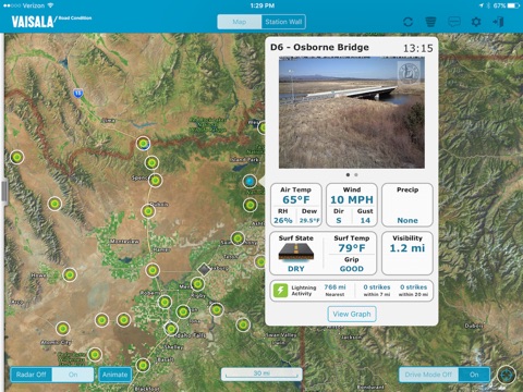
- Atmospheric and Surface observations from Road Weather Stations (RWS) presented via a GIS based map
- RWIS locations color-coded on the map based on surface conditions or surface temperatures
- Camera images from Road Weather Stations
- Weather observations reported from airports (METARs)
- Historical graphs displaying air temperatures, dew point temperatures, and surface temperatures for the last 24-hours for all RWIS locations.
- The proximity of lightning to Road Weather Stations; powered by Vaisalas North American Lightning Detection Network (NALDN) and Vaisalas Global Lightning Dataset (GLD360)
- Weather Radar data and animation
- A user’s current location can be displayed on the map
- Drive Mode allows a user to auto-pan the map keeping the user’s current location centered on the display
- Push notifications informing users of winter surface conditions
- Data filtering based on selected observation criteria
- Weather Outlook forecasts providing the forecasted high and low air temperature along with a weather summary icon covering each of the next three days for each RWIS and METAR location
- On demand data refresh
The app works in conjunction with the Vaisala RoadDSS Data Service.